Kirakat
From high on the drawing board: the Terrán offers an innovative solution for accurate planning

For Terrán, it has always been a priority to provide an appropriate and accessible body of knowledge. In order to make the best possible decision on an important issue such as construction or renovation, it is crucial to have accurate and detailed information. However, in addition to supporting the public, Terrán, which has been around for over a century, has always tried to meet the needs of designers, thus helping architects.
Complex design support interface
The Terrán AddOn programme, which is part of the ArchiCAD programme, also serves to support the profession.
With this complex design support platform specifically designed for architects, all information is available to professionals at the touch of a button.
It allows you to access all relevant, important information not only about roof tiles but also about ancillary products, without leaving the ArchiCAD interface. Specific installation basic data and a photorealistic visualisation complete the design. The interface also provides designers with detailed information on the Generon solar roof tiles, which can be integrated into the plans and placed on the roof as drawn. Thanks to the visualisation plans, the builder can realise the aesthetic benefits of the product at the design stage.
One of the latest innovations in spatial data collection is laser scanning. The architectural engineers and roofing specialists at Terrán, together with the geoinformatics experts at the similarly Hungarian-owned Envirosense Hungary Kft. have jointly developed the EnviMap system.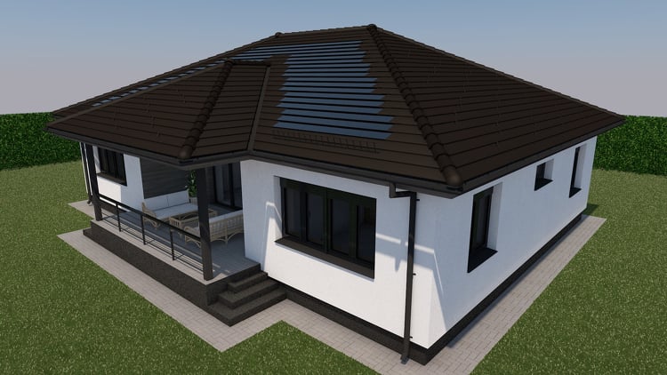
From the air to the ground
The unique LiDAR technology models roof planes with LOD2 detail. The scanner can measure and record tens of millions of points in its environment in a short period of time.
With the EnviMAP, you can retrieve near-realistic, high-detail roof data, including roof area, pitch and pitch angle data. The EnviMAP currently provides information on building geometry data for 2100 municipalities in the country. The aerial laser survey will assist contractors and professionals, supporting accurate design.
Source : Link




It’s time for a refurbishment: HEDO is carrying out work on one of Miskolc’s key transport routes

Four ‘1’s in a row: Esztergom’s transport headache has been resolved

The care home in Fertőd is to be refurbished

An innovative, distinctive PHOENIX Logistics Centre has been established in Győr: the Óbuda Group has reimagined the spaces for pharmaceutical logistics

Rain gardens are coming to Budafok, with over 3,000 square metres of green space set to be developed

Four new bridges to be built in the heart of the former industrial city

Contemporary art deco in Csopakon

Safer driving on the motorways: new digital signs for the MKIF
-

 Kirakat 2026. 10. 01.
A leading machinery distributor in the construction and haulage sectors is building a new service centre and extending its existing premises
-
Industry news 2026. 10. 02.
Hungary has joined the single electricity market
-
Railway development 2026. 09. 29.
The railway line leading to the Hungarian border is also set to be upgraded as part of Croatia’s large-scale development programme
-
Bound track 2026. 10. 07.
Aurora beneath the Apennines – Another tunnel is being built on the Naples–Bari railway line