Bound track
From the tram tracks to the trees’ root zones: complex design work lays the foundations for the second phase of the Buda Interconnection project

The 2.8-kilometre-long new line would run from Szent Gellért Square along the Műegyetem embankment and the Pázmány Péter Promenade, then turn onto Dombóvári Road, leading to the terminus on Budafoki Road. Within the planning area, which is on average thirty metres wide, it was necessary to coordinate the space requirements of the double-track tramway, public roads, utility networks, continuous pedestrian and cycle routes, and vegetation. The project also encompassed the regeneration of public spaces along the banks of the Danube. The project manager at the FŐMTERV Railway and Overhead Line Office, Ákos Priváczki-Juhász provided our portal with information on the wide-ranging criteria and background to the design.
The previous plans were reviewed in the light of new requirements
Planning permission and construction drawings for the project had already been drawn up as part of the BudaPart development. Their redesign was necessitated by a government decree issued in 2020. The requirements set out under the new public investment scheme prioritised climate protection, urban development and landscape design considerations alongside transport functions. The experts at FŐMTERV reviewed the previous proposals across all relevant disciplines. The aim was to ensure that the new tram line could be realised as infrastructure that works in harmony with the surrounding urban area.
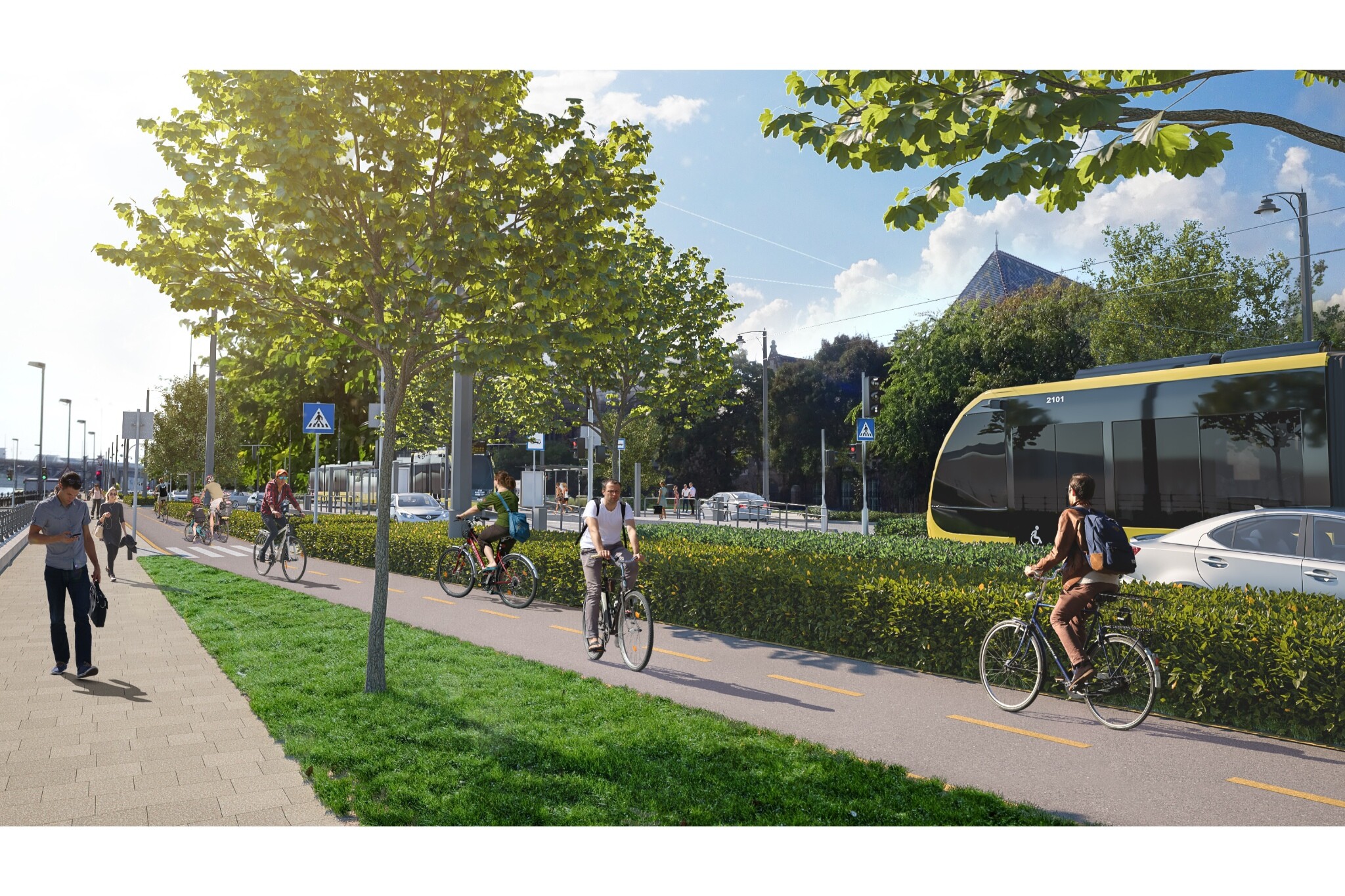
Ákos Priváczki-Juhász cited the increase in green spaces, the creation of a grass-covered tram track and the preservation of existing tree-lined avenues to the greatest extent possible as among the most important changes. In addition, it was necessary to ensure a continuous, direct pedestrian and cycle route along the banks of the Danube.
The continuity of coastal routes is a key consideration
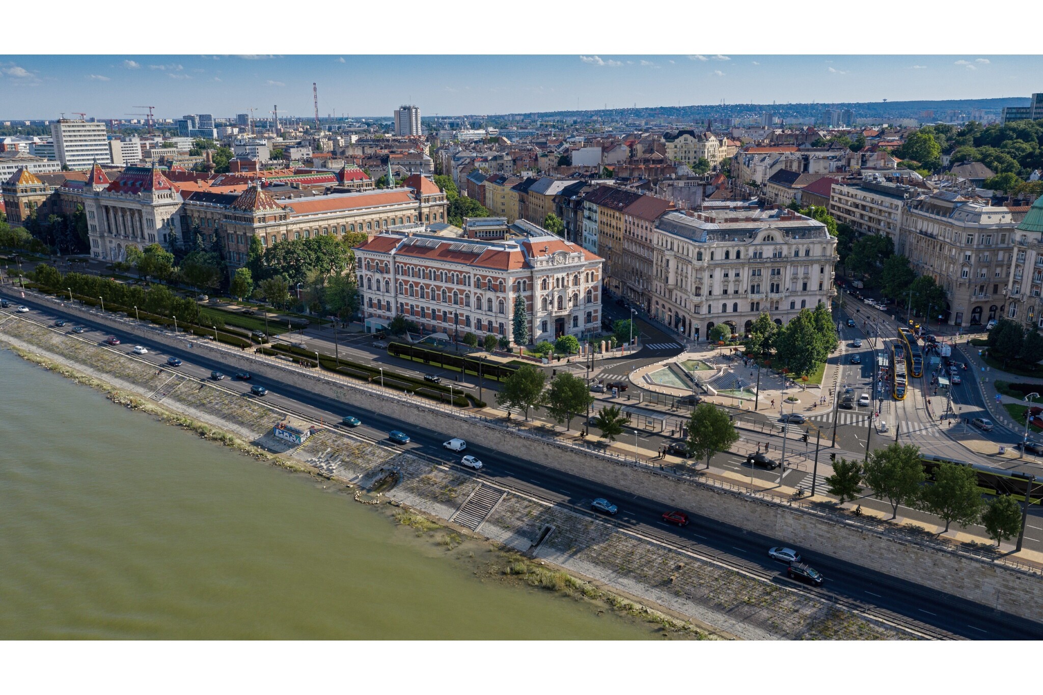
As part of the decision-making process, the geometric design of the tram route, the location of stops, road traffic arrangements and options for the redevelopment of public spaces were examined collectively. The experts drew up alternatives for, amongst other things, the design of the platforms at the Pázmány Péter Promenade stops, the reduction of road capacity at Szent Gellért Square, and pedestrian and cycle links under the Petőfi Bridge. The planners sought a coordinated solution which, alongside the development of tram transport, would also improve the usability and quality of public spaces along the Danube embankment.
The selected option was chosen from among the variants examined during the decision-making process, following an assessment of technical feasibility, transport functionality and cost-effectiveness. The continuity of the riverside routes, the preservation of the tree-lined avenues and the increase in green spaces were also key considerations in the decision.
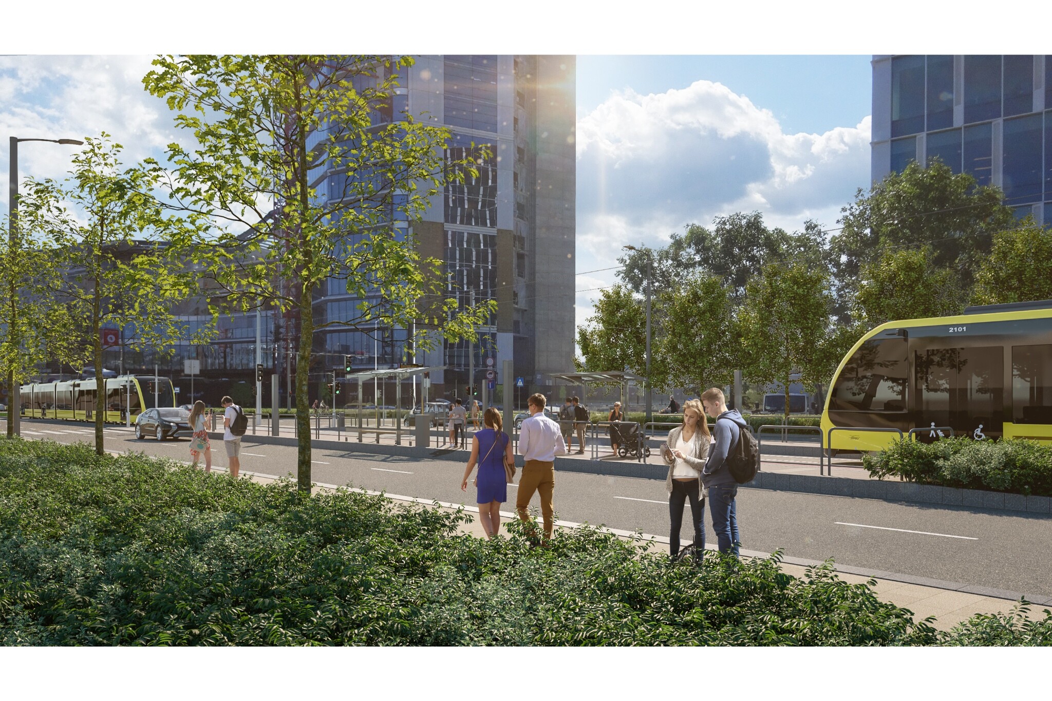
The work on FŐMTERV covered the entire preparation process
The scope of the design work for project FŐMTERV ranged from the preparation of decision-support documentation, through the consolidated authorisation and construction drawings, to the necessary authorisation procedures, as well as the compilation of the tender documentation required for public procurement. The relevant environmental, archaeological, heritage protection and regulatory aspects were developed, along with the visualisation plans, and the information materials were compiled. With regard to the technical content, a feasibility study and a cost-benefit analysis were also prepared in accordance with the eligibility criteria set out in IKOP Plusz. In the next phase, work will continue with the design services required for construction.
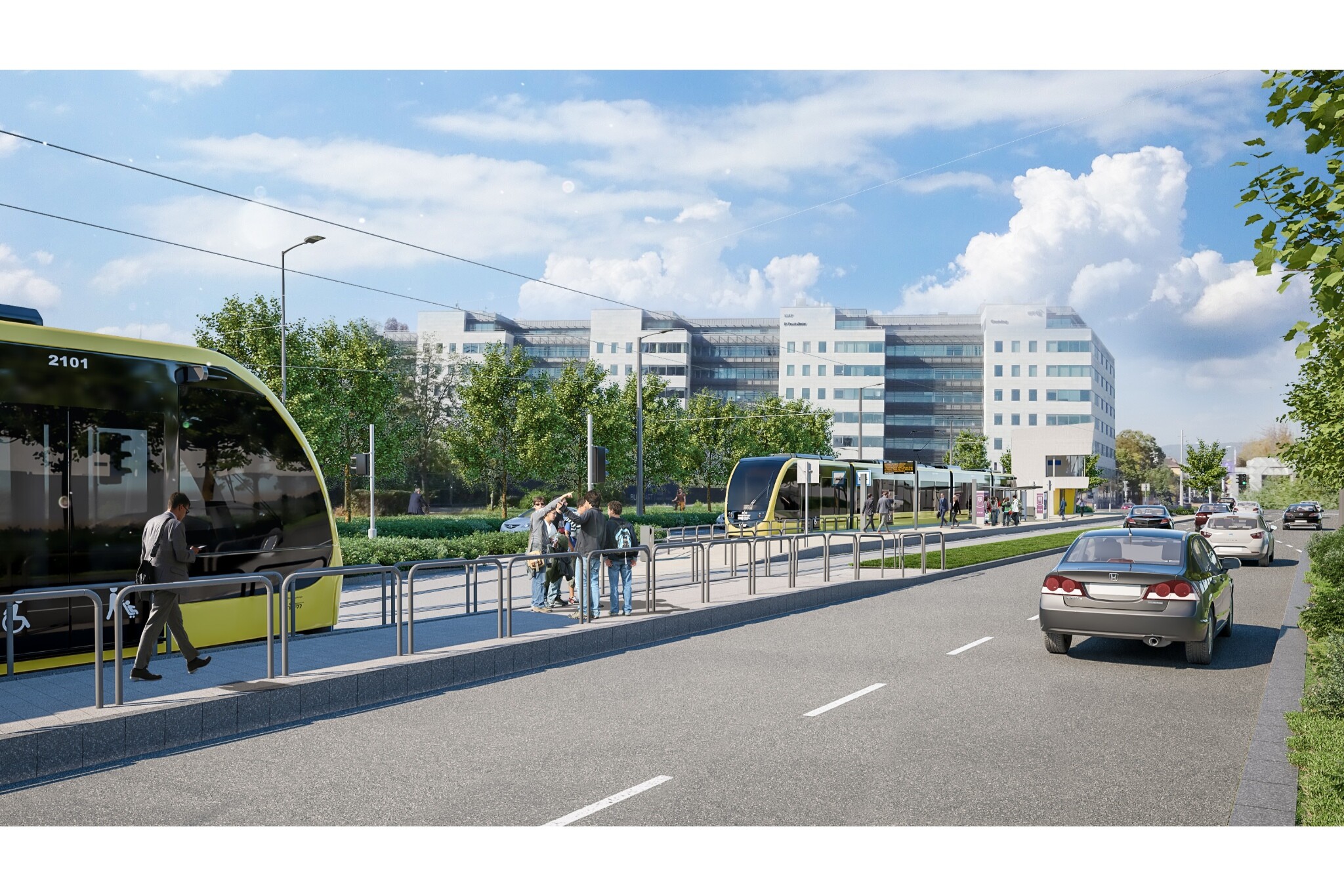
Redesigning the narrow spaces beneath the bridges proved to be a challenge
The most complex engineering task was the coordination of the interrelated design considerations arising within the confined urban space. The redesign of junctions with narrow cross-sections and the areas beneath bridges presented a particularly significant challenge.
„The task was not merely to design a tram line, but to develop the entire urban environment as a functional, integrated system”
– said Ákos Priváczki-Juhász. The space requirements of the various facilities were coordinated through close cooperation between the different disciplines and a comprehensive redesign of the entire public space. The positioning of the tram tracks, overhead lines and associated infrastructure, as well as adaptation to existing utilities, required bespoke utility and structural engineering solutions in several places. Preserving the tree-lined avenues remained a key consideration in the design of these solutions.
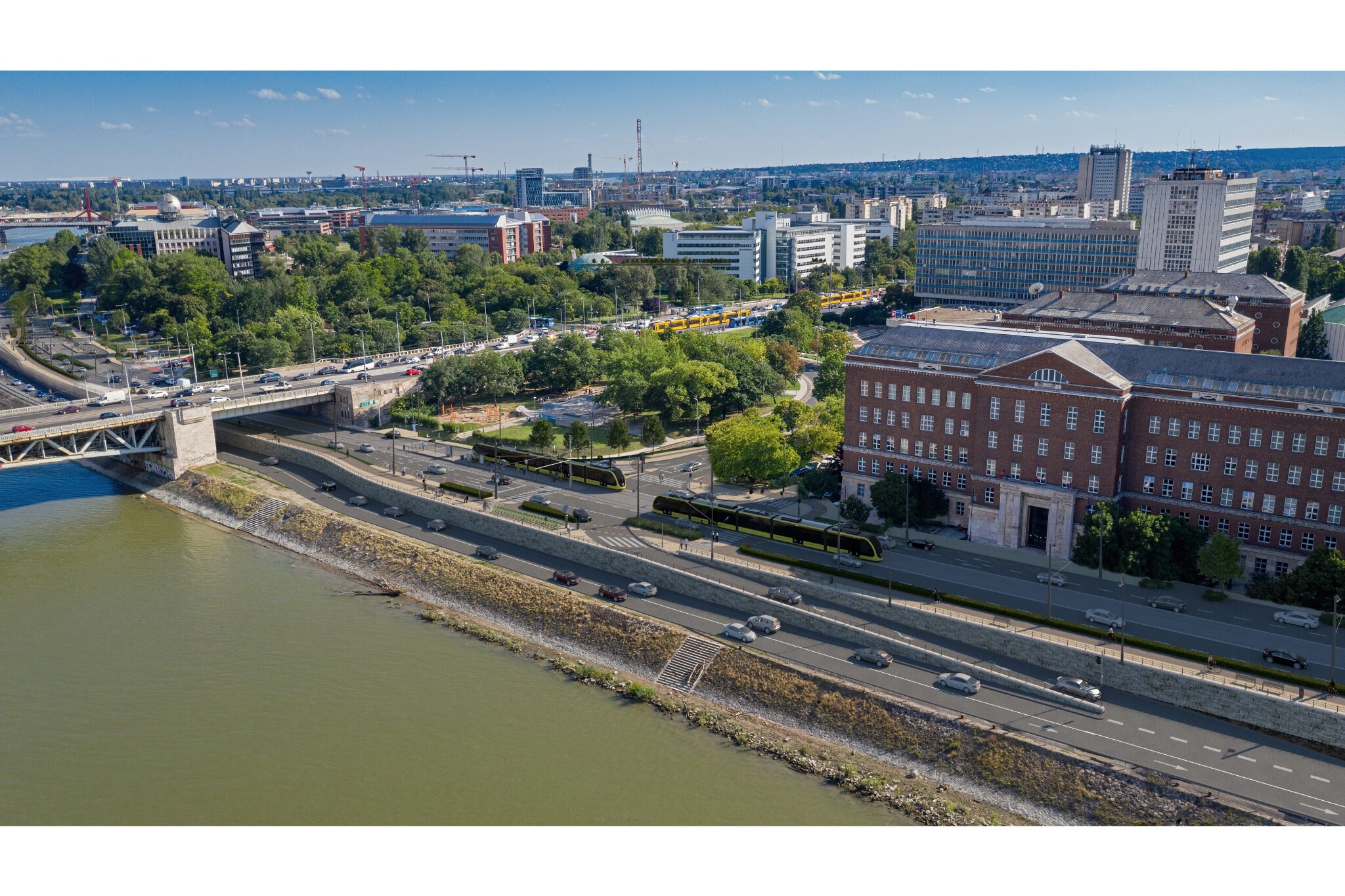
Almost half of the tram route may be constructed with a grass-covered surface
Of the planned 2.8-kilometre, double-track tram line, 1.2 kilometres would be constructed with a grass-covered track bed. Experts have selected different track structures for the various sections of the line.
For the grass-covered sections, the plans specify a 59R2 grooved rail system with reinforced concrete longitudinal beams, using the RAFS III system. On the paved sections, a reinforced concrete slab track structure would be used, with granite paving in certain prominent areas. The turnouts and crossings would be paved with basalt concrete. The track design also addresses the mitigation of noise and vibration impacts on the surrounding environment, achieved through flexible rail fastening and grouting solutions.
The construction of a 2,850-metre-long overhead line forms part of the tramway infrastructure. The design tasks include the installation of a current return system, the conversion and construction of the BKV direct current network, and the refurbishment of a tramway power converter.
The experts at FŐMTERV have also drawn up plans for the reconstruction of the public lighting system. The design brief also covered the necessary utility replacements. A point-switching system was designed for two locations – Szent Gellért Square and the Budafoki út terminus – whilst point heating was designed for three locations.
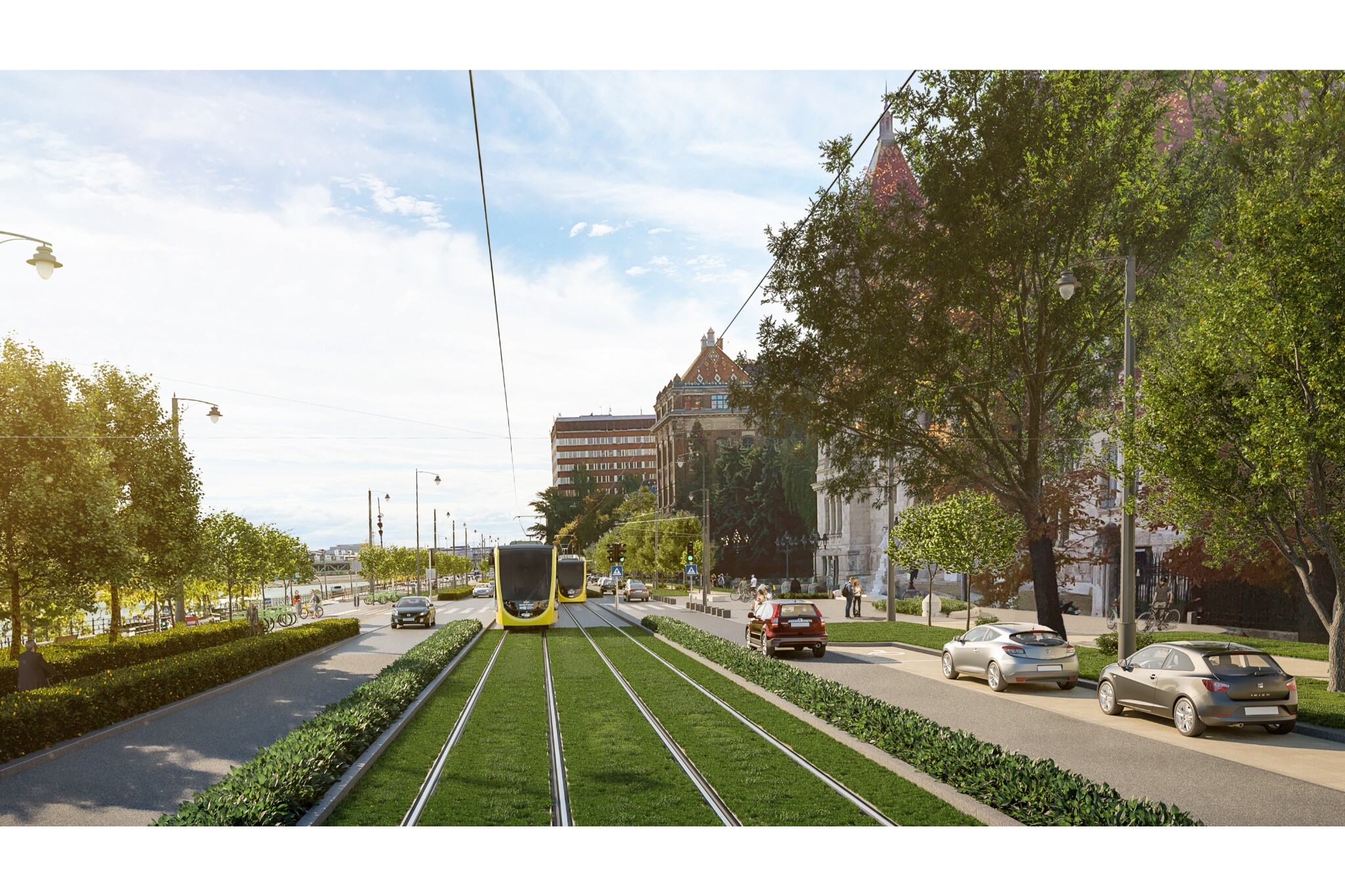
The project involves sixteen transport hubs
The development involves road construction and traffic management works along a 2.8-kilometre stretch.
The project involves 16 road junctions, and traffic signalling equipment may be installed at 15 of them. The project manager told us that the planning process took into account road capacity, the need to avoid congestion and the requirements of tram services.
By coordinating traffic light control, more favourable conditions for trams to pass through can be created. In this regard, Ákos Priváczki-Juhász also pointed out that, in a congested urban environment, it is crucial to determine the schedule for the works. It has become necessary to divide the works into several phases in order to maintain transport services. An important consideration is that one of the district’s main transport routes will not be closed along its entire length all at once.
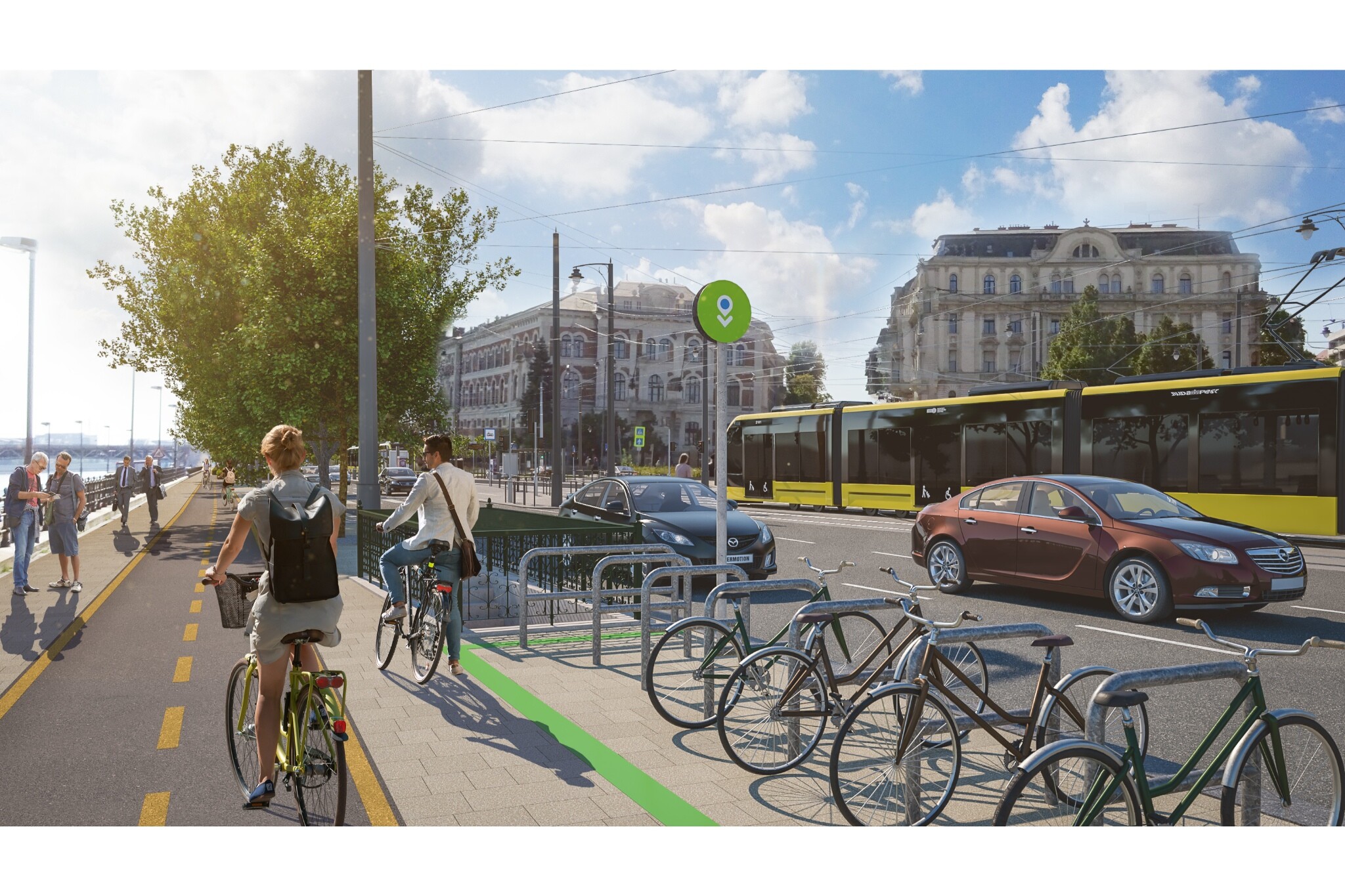
The Stockholm method was also used, which represents a new opportunity in domestic planning
In the case of the new design variants, increasing green spaces and preserving the existing vegetation have become a priority. Ákos Priváczki-Juhász explained that, during the planning process, they also sought to improve the living conditions of the trees to be retained in the project area. One of the tools used for this is the Stockholm method, which helps to create a more favourable root zone for trees in paved urban environments. The project manager added that the method was applied in the design along Dombóvári Road and the quay in those places where the width of the available green space was less than one and a half metres.
Creating an appropriate root zone can help ensure the long-term survival of tree-lined avenues, improve local rainwater retention, and make urban green spaces more resilient to heat and drought. According to the expert, this method also opens up new possibilities in urban infrastructure planning in Hungary: the design of transport infrastructure and the protection of trees can be coordinated, whilst the needs of vegetation can become an integral part of public space planning.
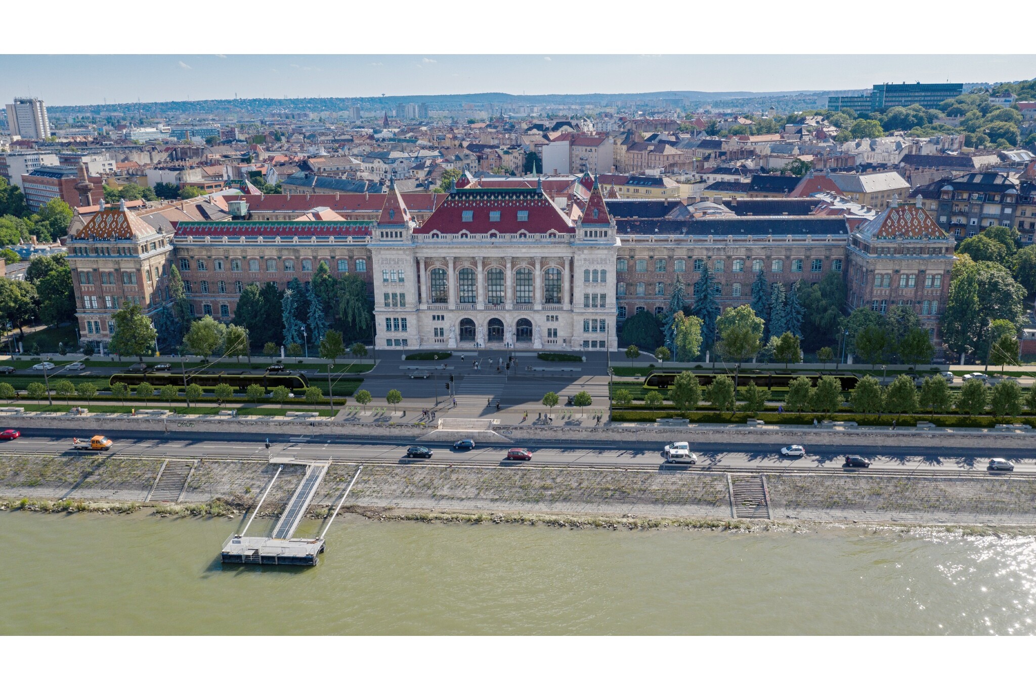
The quay in front of the University of Technology is also set to be redeveloped as a public space
The project includes the redevelopment of the upper embankment in front of the University of Technology, as well as the reorganisation of the traffic flow and streetscape along the University of Technology embankment and the Pázmány Péter Promenade. According to the urban design concept, the area in front of the University of Technology would also serve the city as a high-quality, prestigious public space. The plans envisage a reduction in paved surfaces and motorised traffic, an increase in green spaces, the development of pedestrian and cycle routes, and the creation of a space that is more open towards the Danube.
Between St Gellért Square and Rákóczi Bridge, the tram line, the riverside promenade and the cycling infrastructure would form a coordinated transport system.
Connection to the suburban railway
The plans include the construction of seven accessible bus stops:
- St Gellért Square – Technical University M;
- Lajos Bertalan Street;
- Petőfi Bridge, Buda side;
- A tour by Hungarian scientists;
- Péter Pázmány Promenade;
- Nádorkert railway station;
- Budafoki út/Dombóvári út terminus.
When designing the stations and their connections to the ground level, the focus was placed on ensuring safe passenger transfers, alongside barrier-free access. The surroundings of the platforms were designed in conjunction with the infrastructure for pedestrians and cyclists. A key consideration was the connection to the public cycle-sharing scheme.
As part of the project, a new terminus station building was also designed at the Dombóvári út junction. In the Nádorkert area, a new interchange facility would be created in connection with the Déli körvasút project. This would enable the tram and suburban rail services to complement one another, thereby improving transport links to the university quarter (Infopark) and the Kopaszi Dam and BudaPart areas.
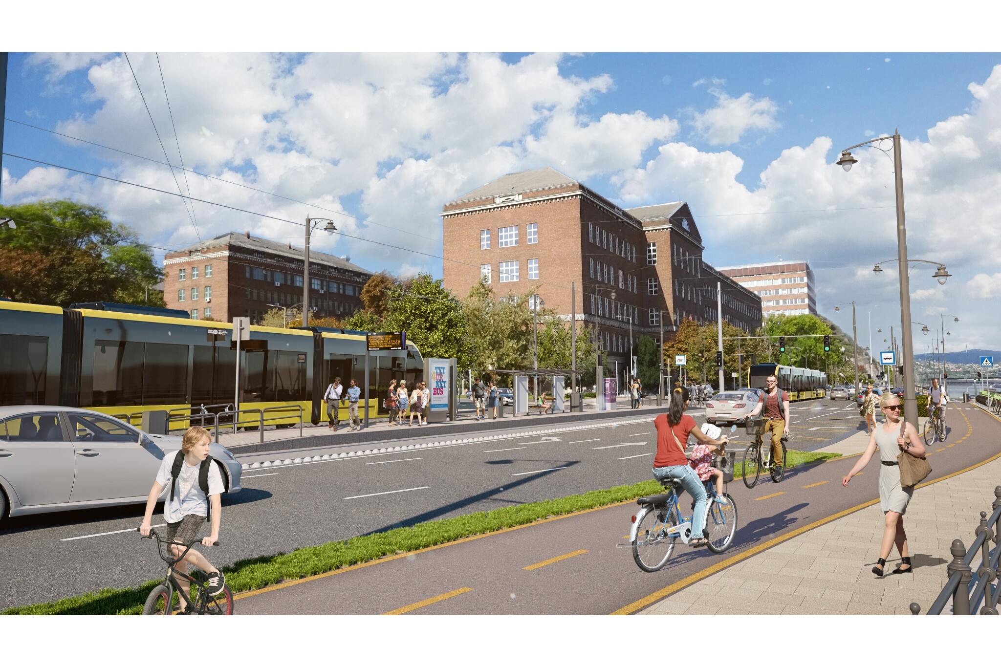
The simulations indicated a journey time of eight to nine minutes
What are the benefits of constructing this new interconnecting line? Based on model calculations, the estimated daily passenger volume at the critical section in the network scenarios analysed for 2030 is between 17,000 and 24,000 passengers.
The project manager said,
Simulations indicated a journey time of around 8–9 minutes for trams on the section between Budafoki út and Szent Gellért tér.
This forecast – he noted – does not show the time savings compared with other modes of transport. The expected social benefits included travel time savings, improved accessibility to routes BudaPart and Infopark, and the promotion of sustainable modes of transport. The environmental objectives are supported by the grass-covered track, the protection of existing tree-lined avenues and the development of infrastructure for pedestrians and cyclists.
As our website previously reported, the SWIETELSKY Magyarország Kft. and SWIETELSKY Vasúttechnika Kft.; work is expected to begin later this year.
Source: Link










The area around Malom Lake in Oroszlány has been revitalised with the addition of an owl castle and a viewing hill

Lenti’s spa is being developed with the largest available small-scale solar power capacity

From the tram tracks to the trees’ root zones: complex design work lays the foundations for the second phase of the Buda Interconnection project

Mester Street is being redeveloped in a confined space alongside tram traffic

Four new bridges to be built in the heart of the former industrial city

Rain gardens are coming to Budafok, with over 3,000 square metres of green space set to be developed

Contemporary art deco in Csopakon

Safer driving on the motorways: new digital signs for the MKIF
-

 Bound track 2026. 09. 18.
Work has begun: the spur line will provide a direct rail link between Szombathely and Zalaegerszeg
-
Current at 2026. 09. 17.
The contractors for the Szolnok spa have brought a lawsuit against the city to secure payment of their final invoice
-
Industry news 2026. 09. 19.
Duna Aszfalt paid more than 10 billion forints in interest to state-owned banks
-
Climate-X 2026. 09. 22.
From the heating plant to the library – solar panels are to be installed on eight local authority buildings in Kiskunfélegyháza